How to Assess Flood and Drainage Risks in Bangkok
Bangkok, renowned for its vibrant culture and dynamic real estate market, also faces significant challenges from flooding and drainage issues. For prospective buyers, investors, and residents alike, understanding how to evaluate flood susceptibility and drainage hazards is essential. Proper risk assessment can save you thousands in potential damages and ensure your property remains a safe and secure investment. This guide offers expert insights and practical tips on assessing location risks related to floods and drainage problems in Bangkok, empowering you to identify safer sites swiftly and confidently.
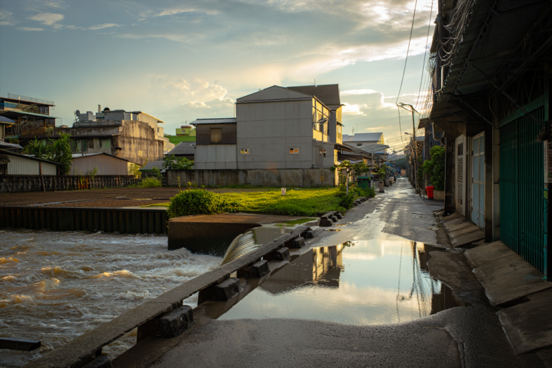
Why Flood and Drainage Risks Matter in Bangkok
Bangkok is particularly vulnerable to flooding due to its low-lying topography, monsoon season, and aging drainage infrastructure. Unchecked, these risks can lead to:
- Property water damage
- Structural deterioration
- Health hazards from mold and bacteria
- Decreased property value
- Increased insurance costs
By proactively assessing flood and drainage risks, you safeguard your investment and ensure a resilient living environment.
Key Factors to Evaluate Flood Susceptibility in Bangkok
Assessing flood risk involves analyzing a combination of geographic, infrastructural, and environmental factors.
1. Topography and Elevation
Critical Point: Low-lying areas are inherently more prone to flooding.
- Check the property’s elevation relative to sea level – properties located significantly above flood plains tend to be safer.
- Use topographic maps or digital elevation models (DEMs) for precise data.
2. Historical Flood Data and Records
Critical Point: Past flooding events indicate areas at higher risk.
- Review local government data and flood history reports.
- Identify zones that experience recurrent flooding, especially during monsoon months.
3. Proximity to Water Bodies and Drainage Channels
Critical Point: Close proximity to rivers, canals, or water retention areas increases flood risk.
- Map nearby rivers, canals, and flood-prone zones.
- Check if the property is located behind flood barriers or within floodplain zones.
4. Drainage Infrastructure Quality
Critical Point: Poor drainage exacerbates flood severity.
- Investigate the condition and capacity of local drainage systems.
- Ask local officials or developers about recent upgrades or maintenance history.
5. Urbanization and Land Use Patterns
Critical Point: Overdevelopment can limit natural water absorption.
- High-density developments with limited green spaces may lead to poor water absorption.
- Look for plans or restrictions for flood mitigation measures like retention basins or permeable pavements.
Practical Tips for On-site Flood Risk Assessment
Meeting with local experts and conducting physical inspections can provide invaluable insights.
- Observe Ground Level: Walk around the site—lower spots tend to flood more.
- Inspect Drainage Outlets: Ensure drains are unblocked and functioning.
- Evaluate Surroundings: Check for signs of past flooding—stained walls, water marks, or puddle accumulation.
- Assess Elevation: Use levels or ask professionals to measure the site’s elevation.
Utilizing Technology and Resources for Accurate Risk Assessment
Modern tools simplify flood risk analysis:
| Tool/Resource | How It Helps | Access Method |
| Flood Maps (e.g., Thailand Flood Risk Map) | Visualize flood-prone zones | Government portals or DIY mapping software |
| GIS Data & Digital Elevation Models | Analyze site elevation and terrain | Professional GIS platforms or local authorities |
| Local Government Records | Understand historical flood events | Request via local municipalities or agency websites |
| Satellite Imagery & Remote Sensing | Detect recent flood impacts and land changes | Platforms like Google Earth or specialized apps |
Consult with Experts for Reliable Evaluation
Engage with local civil engineers, drainage consultants, or real estate experts familiar with Bangkok’s flood dynamics. Their insights provide validation and detailed analysis for complex assessments, especially in high-stakes transactions.
How to Mitigate Identified Risks
After assessment, consider mitigation strategies:
- Elevate Critical Structures: Raising foundations or installing flood barriers.
- Improve Drainage: Installing sump pumps or drainage channels.
- Choose Robust Building Materials: Resistant to water damage.
- Opt for Elevated Properties: Especially in high-risk zones.
Final Thoughts: Securing Safer Sites in Bangkok
Evaluating flood and drainage risks is a vital step in Thailand HomeAtlas’s comprehensive property analysis process. By combining expert evaluation, modern tools, site inspections, and an understanding of local environmental factors, you can confidently identify safer locations and make informed investment decisions. Remember, a proactive approach today can save you significant costs and stress tomorrow—take the first step toward a secure Bangkok property now.
Frequently Asked Questions (FAQs)
Q1: How do I know if a property in Bangkok is flood-resistant? A1: Check its elevation, proximity to water bodies, drainage infrastructure condition, and historical flood data. Consulting professionals and using digital tools can provide precise insights.
Q2: Are there areas in Bangkok less prone to floods? A2: Yes. Elevated districts or areas with recent flood mitigation infrastructure are generally safer. Neighborhoods outside flood plains or with good drainage systems tend to have lower risks.
Q3: What legal or insurance considerations relate to flood risk? A3: Some zones may have higher insurance premiums or restrictions. Always verify local regulations and consult with insurers familiar with flood zones for comprehensive coverage options.
By understanding and assessing flood and drainage risks effectively, you can confidently choose properties that offer safety, stability, and peace of mind in Bangkok’s ever-evolving landscape.
Continue Exploring
Navigate through our complete atlas of Thailand property guides, market data, and practical relocation tips.
Back to Atlas Home